For the 2018 LTER Science Council Meeting in Madison, Wisconsin, each site gave a 5 minutes overview of site news and a few results focusing on organic matter trends, processing, or transport. The process offered food for thought as science council participants broke into working groups to develop approaches to synthesizing organic matter findings.
Top Stories

The caddisfly stole my heart

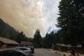
Studying post-fire Snowpack at the H.J. Andrews Experimental Forest

Summer Network-wide Postcard Exchange
What would my project be?
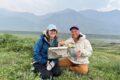
ILTER Webinar: Resolving and scaling litter decomposition controls from leaf to landscape
Lessons from Long-Term Data: An ARETs Experience at the H.J. Andrews LTER
Invisible Impacts Symposium
Clotheslines, Hair Ties, and Tape Measures: Low Tech Tools for the Win

Voices of the Forest: Frog Bio-acoustics in the LUQ-LTER
Help shape the ILTER Open Science Conference!